File:1657 map Polus Antarcticus.jpg
From WikiMD's WELLNESSPEDIA

Size of this preview: 682 × 600 pixels. Other resolutions: 2,329 × 2,048 pixels | 5,500 × 4,837 pixels.
Original file (5,500 × 4,837 pixels, file size: 2.34 MB, MIME type: image/jpeg)
Summary[edit]
| Summary | |
|---|---|
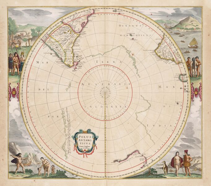
| Description | Map of the southern polar regions: Polus Antarcticus cum regionibus subjacentibus et maribus illum alluentibus ("The Antarctic pole with the adjoining regions and seas flowing near it."). From Atlantis majoris quinta pars... the fifth part of the 1657 Atlas Major by Jan Janssonius (1588-1664). |
| Source | Wikimedia Commons file page |
| Author | Jan Janssonius |
| Permission | See original Commons license details. |
Licensing[edit]
Public Domain
This file is in the public domain and may be used without restriction.
Please see the linked source page for the original file history, attribution information, and licensing details.
Original attribution and file history: Wikimedia Commons
File history
Click on a date/time to view the file as it appeared at that time.
| Date/Time | Thumbnail | Dimensions | User | Comment | |
|---|---|---|---|---|---|
| current | 02:10, 7 June 2026 | | 5,500 × 4,837 (2.34 MB) | Maintenance script (talk | contribs) | == Summary == Importing file |
You cannot overwrite this file.
File usage
The following page uses this file:
