File:16th century Portuguese Spanish trade routes.png
Original file (2,835 × 1,188 pixels, file size: 2 MB, MIME type: image/png)
Summary[edit]
| Summary | |
|---|---|
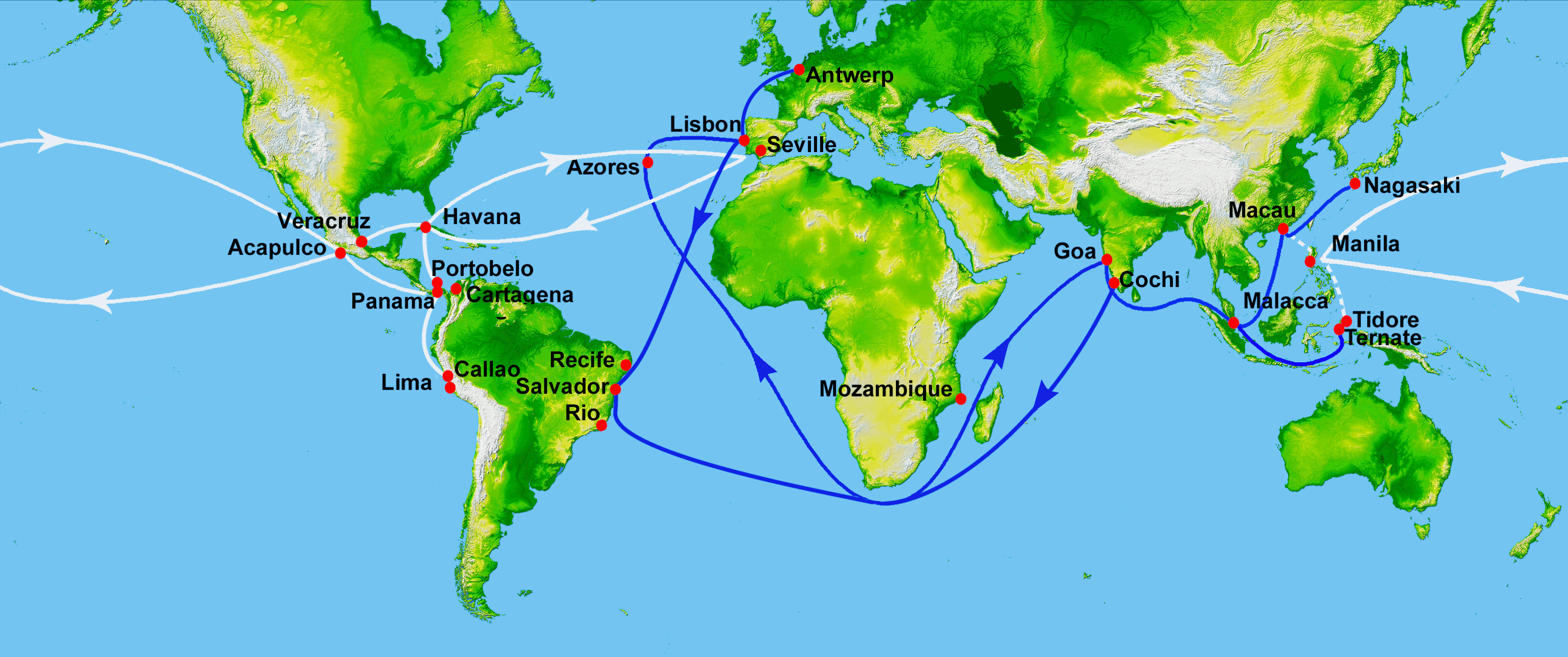
| Description | Map showing main Portuguese (blue) and Spanish (white) oceanic trade routes in the 16th century, as a result of the exploration during the Age of Discovery.
Showing the Spanish colonial Manila-Acapulco Galleons route (1565-1815) between the Viceroyalty of New Spain (México) and the Spanish East Indies (Philippines), using the ports of Acapulco and Cavite. PIA03395: World in Mercator Projection, Shaded Relief and Colored Height
|
| Source | Wikimedia Commons file page |
| Author | World_Topography.jpg: NASA/JPL/NIMA derivative work: Uxbona (talk) |
| Permission | See original Commons license details. |
Licensing[edit]
Public Domain
This file is in the public domain and may be used without restriction.
Please see the linked source page for the original file history, attribution information, and licensing details.
Original attribution and file history: Wikimedia Commons
File history
Click on a date/time to view the file as it appeared at that time.
| Date/Time | Thumbnail | Dimensions | User | Comment | |
|---|---|---|---|---|---|
| current | 02:14, 7 June 2026 | | 2,835 × 1,188 (2 MB) | Maintenance script (talk | contribs) | == Summary == Importing file |
You cannot overwrite this file.
File usage
The following page uses this file:
