File:1732 map of Maryland.jpg
From WikiMD's WELLNESSPEDIA
Size of this preview: 369 × 599 pixels. Other resolution: 2,440 × 3,964 pixels.
Original file (2,440 × 3,964 pixels, file size: 478 KB, MIME type: image/jpeg)
Summary[edit]
| Summary | |
|---|---|
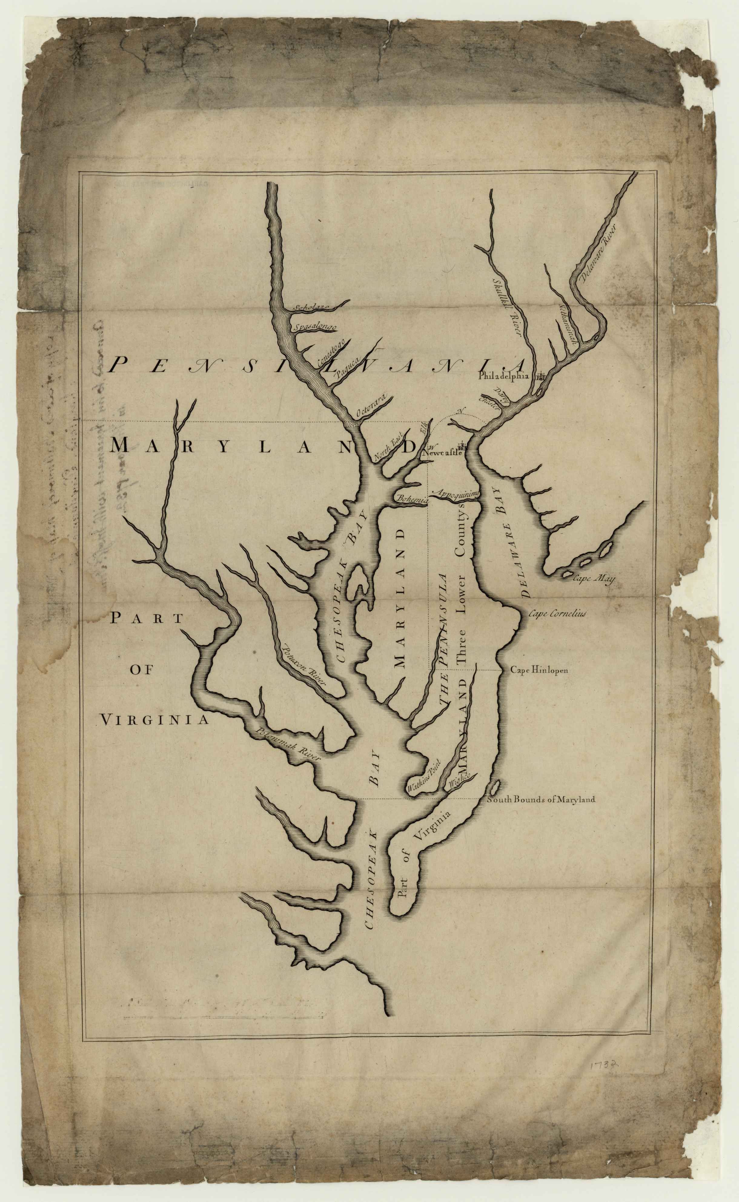
| Description | Description Lord Baltimore’s map of Maryland, Pennsylvania, etc., annexed to his agreement with Messrs. Penn in the year 1732. Map made to accompany agreement between Lord Baltimore and Messrs. Penn |
| Source | Wikimedia Commons file page |
| Author | Unknown authorUnknown author |
| Permission | See original Commons license details. |
Licensing[edit]
Public Domain
This file is in the public domain and may be used without restriction.
Please see the linked source page for the original file history, attribution information, and licensing details.
Original attribution and file history: Wikimedia Commons
File history
Click on a date/time to view the file as it appeared at that time.
| Date/Time | Thumbnail | Dimensions | User | Comment | |
|---|---|---|---|---|---|
| current | 02:09, 7 June 2026 | | 2,440 × 3,964 (478 KB) | Maintenance script (talk | contribs) | == Summary == Importing file |
You cannot overwrite this file.
File usage
The following page uses this file:
