File:1916 political map of Europe.jpg
From WikiMD's WELLNESSPEDIA
Size of this preview: 794 × 600 pixels. Other resolutions: 2,560 × 1,934 pixels | 3,276 × 2,475 pixels.
Original file (3,276 × 2,475 pixels, file size: 9.61 MB, MIME type: image/jpeg)
Summary[edit]
| Summary | |
|---|---|
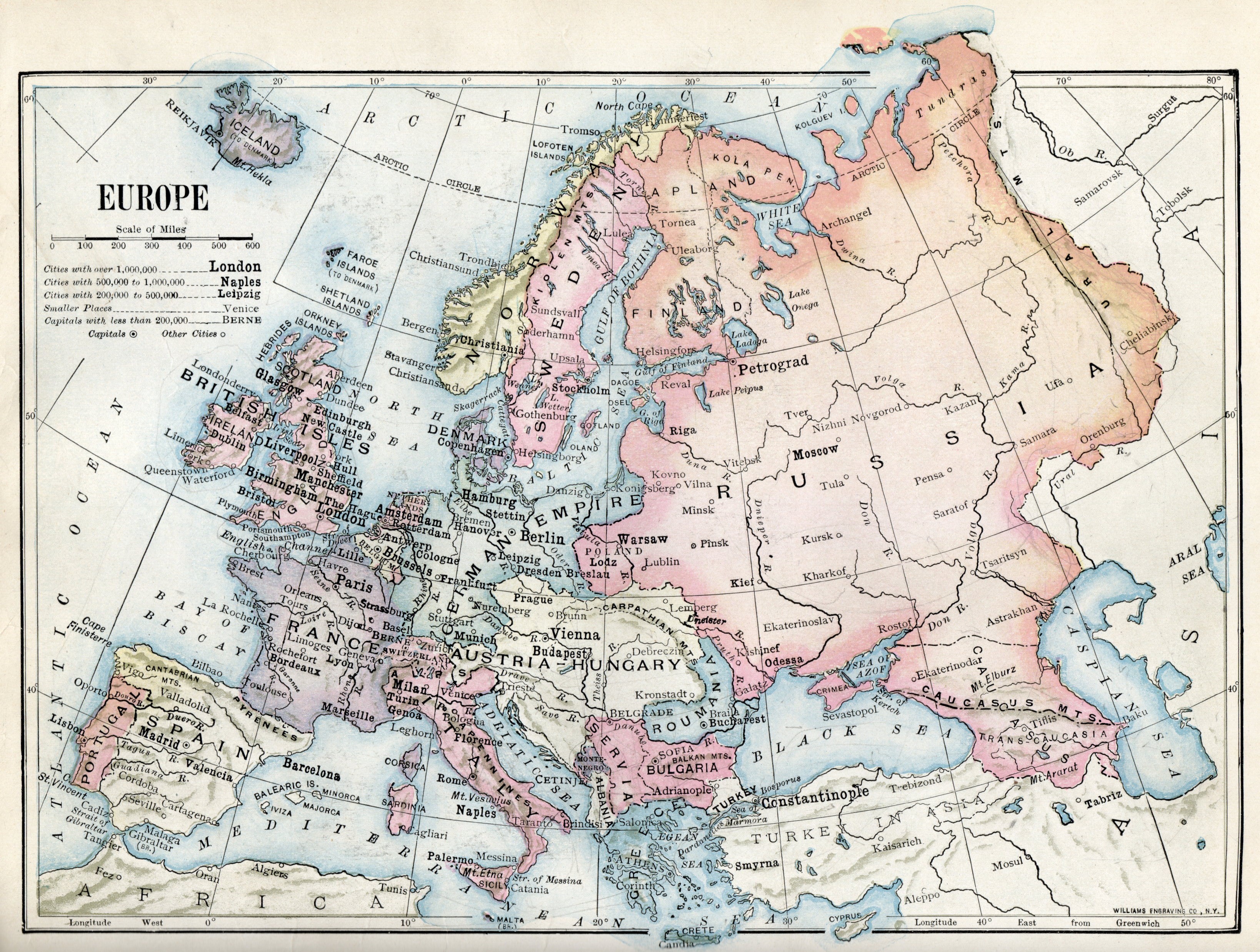
| Description | 1916 political map of Europe from a geography textbook |
| Source | Wikimedia Commons file page |
| Author | Ralph Stockman Tarr / Frank Morton McMurry |
| Permission | See original Commons license details. |
Licensing[edit]
Public Domain
This file is in the public domain and may be used without restriction.
Please see the linked source page for the original file history, attribution information, and licensing details.
Original attribution and file history: Wikimedia Commons
File history
Click on a date/time to view the file as it appeared at that time.
| Date/Time | Thumbnail | Dimensions | User | Comment | |
|---|---|---|---|---|---|
| current | 02:05, 7 June 2026 | | 3,276 × 2,475 (9.61 MB) | Maintenance script (talk | contribs) | == Summary == Importing file |
You cannot overwrite this file.
File usage
The following file is a duplicate of this file (more details):
- File:1916 political map of Europe.jpg from Wikimedia Commons
The following page uses this file:
