File:20180519 USGS Leilani Estates Hawaii Volcanic EruptionDSC 0411 medium.jpg
From WikiMD's WELLNESSPEDIA
Size of this preview: 800 × 534 pixels. Other resolution: 1,020 × 681 pixels.
Original file (1,020 × 681 pixels, file size: 150 KB, MIME type: image/jpeg)
Summary[edit]
| Summary | |
|---|---|
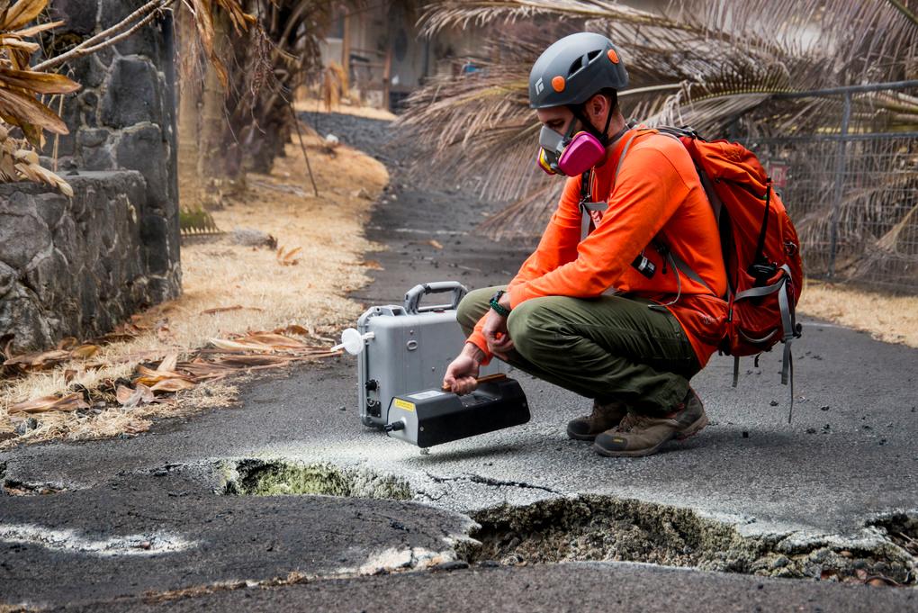
| Description | Pāhoa, Hawaii, May 19, 2018 – U.S. Geological Survey (USGS) volunteer Allan Lerner uses hydrogen sulfide (H2S) and sulfur dioxide (SO2) sensors to test the air quality after the Kīlauea volcanic eruption. The residential area of Leilani Estates has been evacuated due to the high concentration of SO2 emitting from the cracks in the earth that spilled lava into the subdivisions. At the request of the state, FEMA staff are on the ground to support local officials with life-saving emergency protective measures, debris removal, and the repair, replacement, or restoration of disaster-damaged publicly-owned facilities. Photo: Grace Simoneau/FEMA |
| Source | Wikimedia Commons file page |
| Author | Grace Simoneau/FEMA |
| Permission | See original Commons license details. |
Licensing[edit]
Public Domain
This file is in the public domain and may be used without restriction.
Please see the linked source page for the original file history, attribution information, and licensing details.
Original attribution and file history: Wikimedia Commons
File history
Click on a date/time to view the file as it appeared at that time.
| Date/Time | Thumbnail | Dimensions | User | Comment | |
|---|---|---|---|---|---|
| current | 02:14, 7 June 2026 | | 1,020 × 681 (150 KB) | Maintenance script (talk | contribs) | == Summary == Importing file |
You cannot overwrite this file.
File usage
The following file is a duplicate of this file (more details):
- File:20180519 USGS Leilani Estates Hawaii Volcanic EruptionDSC 0411 medium.jpg from Wikimedia Commons
The following page uses this file:
