File:Guy's and St. Thomas' Hospitals from 1833 Schmollinger map.jpg
From WikiMD's WELLNESSPEDIA
Size of this preview: 655 × 600 pixels. Other resolution: 664 × 608 pixels.
Original file (664 × 608 pixels, file size: 336 KB, MIME type: image/jpeg)
Summary[edit]
| Summary | |
|---|---|
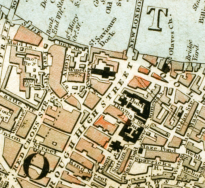
| Description | Section of "Improved map of London for 1833, from Actual Survey. Engraved by W. Schmollinger, 27 Goswell Terrace" showing the sites of Guy's and St. Thomas' hospitals. |
| Source | Wikimedia Commons file page |
| Author | See Wikimedia Commons file page |
| Permission | See original Commons license details. |
Licensing[edit]
Public Domain
This file is in the public domain and may be used without restriction.
Please see the linked source page for the original file history, attribution information, and licensing details.
Original attribution and file history: Wikimedia Commons
File history
Click on a date/time to view the file as it appeared at that time.
| Date/Time | Thumbnail | Dimensions | User | Comment | |
|---|---|---|---|---|---|
| current | 03:24, 5 June 2026 | | 664 × 608 (336 KB) | Maintenance script (talk | contribs) | == Summary == Importing file |
You cannot overwrite this file.
File usage
The following 2 pages use this file:
