File:ISS View of the Southwestern USA.JPG
From WikiMD's WELLNESSPEDIA
Size of this preview: 800 × 532 pixels. Other resolutions: 2,560 × 1,701 pixels | 4,288 × 2,850 pixels.
Original file (4,288 × 2,850 pixels, file size: 2.27 MB, MIME type: image/jpeg)
Summary[edit]
| Summary | |
|---|---|
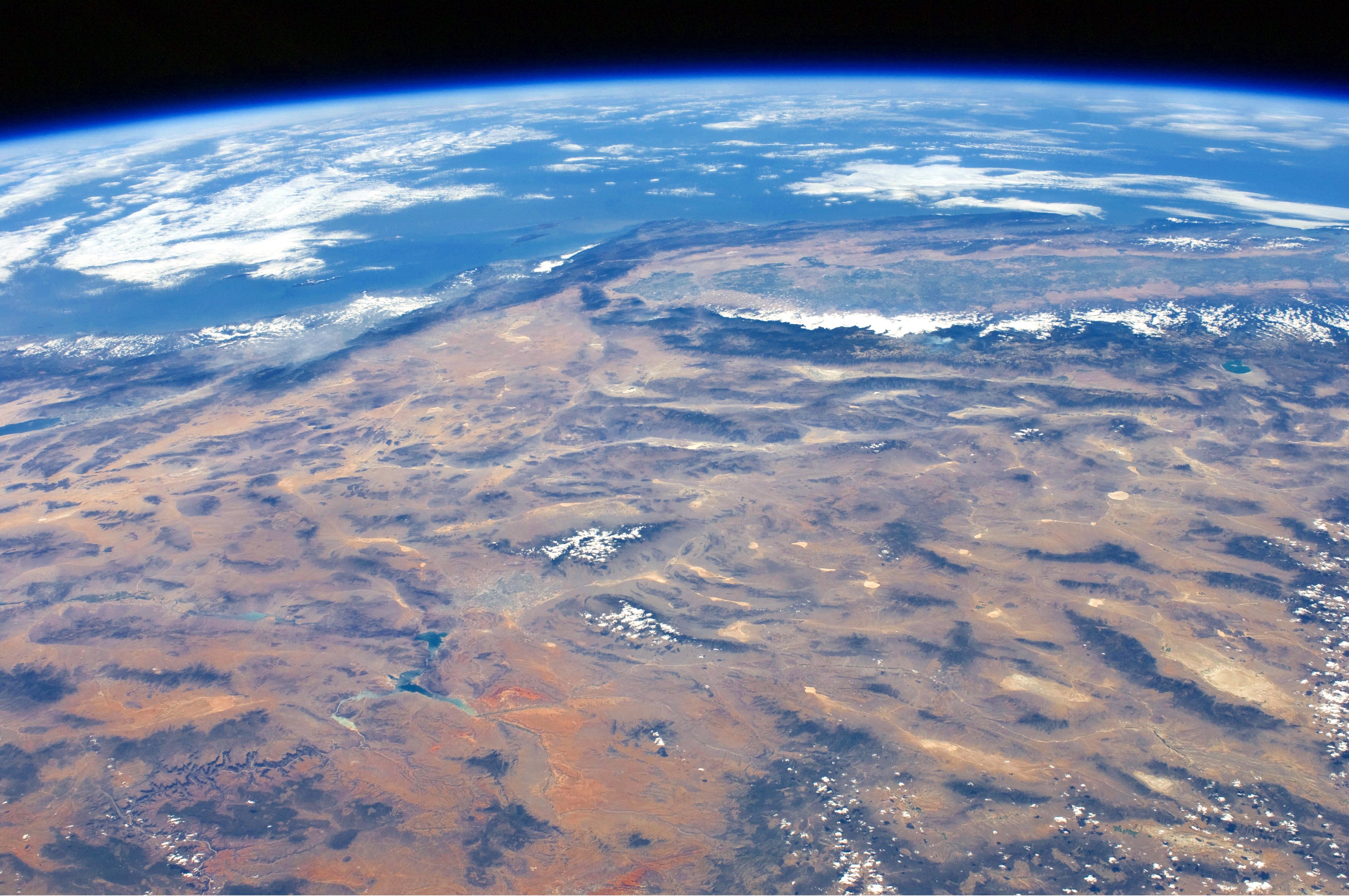
| Description | This panoramic view of the south-western United States and Pacific Ocean was taken by an astronaut looking out mostly West at an angle from the International Space Station (ISS). The image includes parts of Arizona, Nevada, Utah, and California. The Las Vegas metropolitan area appears as a gray region adjacent to the Spring Mountains and Sheep Range (both covered by white clouds). The Grand Canyon, located on the Colorado Plateau in Arizona, is visible to the east of Las Vegas, with the blue waters of Lake Mead in between. The image also includes the Mojave Desert, stretching north from the Salton Sea (center left) to the Sierra Nevada mountain range. The Sierra Nevada is roughly 640 km long (north-south) and forms the boundary between the Central Valley of California and the adjacent Basin and Range physiographic province. The Basin and Range is so called because of the pattern of long linear valleys separated by parallel mountain ranges. The landscape was formed by extension and thinning of the Earth’s crust. |
| Source | Wikimedia Commons file page |
| Author | ISS Expedition 24 crew |
| Permission | See original Commons license details. |
Licensing[edit]
Public Domain
This file is in the public domain and may be used without restriction.
Please see the linked source page for the original file history, attribution information, and licensing details.
Original attribution and file history: Wikimedia Commons
File history
Click on a date/time to view the file as it appeared at that time.
| Date/Time | Thumbnail | Dimensions | User | Comment | |
|---|---|---|---|---|---|
| current | 22:33, 8 June 2026 | | 4,288 × 2,850 (2.27 MB) | Maintenance script (talk | contribs) | == Summary == Importing file |
You cannot overwrite this file.
File usage
The following file is a duplicate of this file (more details):
- File:ISS View of the Southwestern USA.JPG from Wikimedia Commons
The following page uses this file:
