File:Map-Francophone World.svg

Original file (SVG file, nominally 512 × 262 pixels, file size: 878 KB)
Summary[edit]
| Summary | |
|---|---|
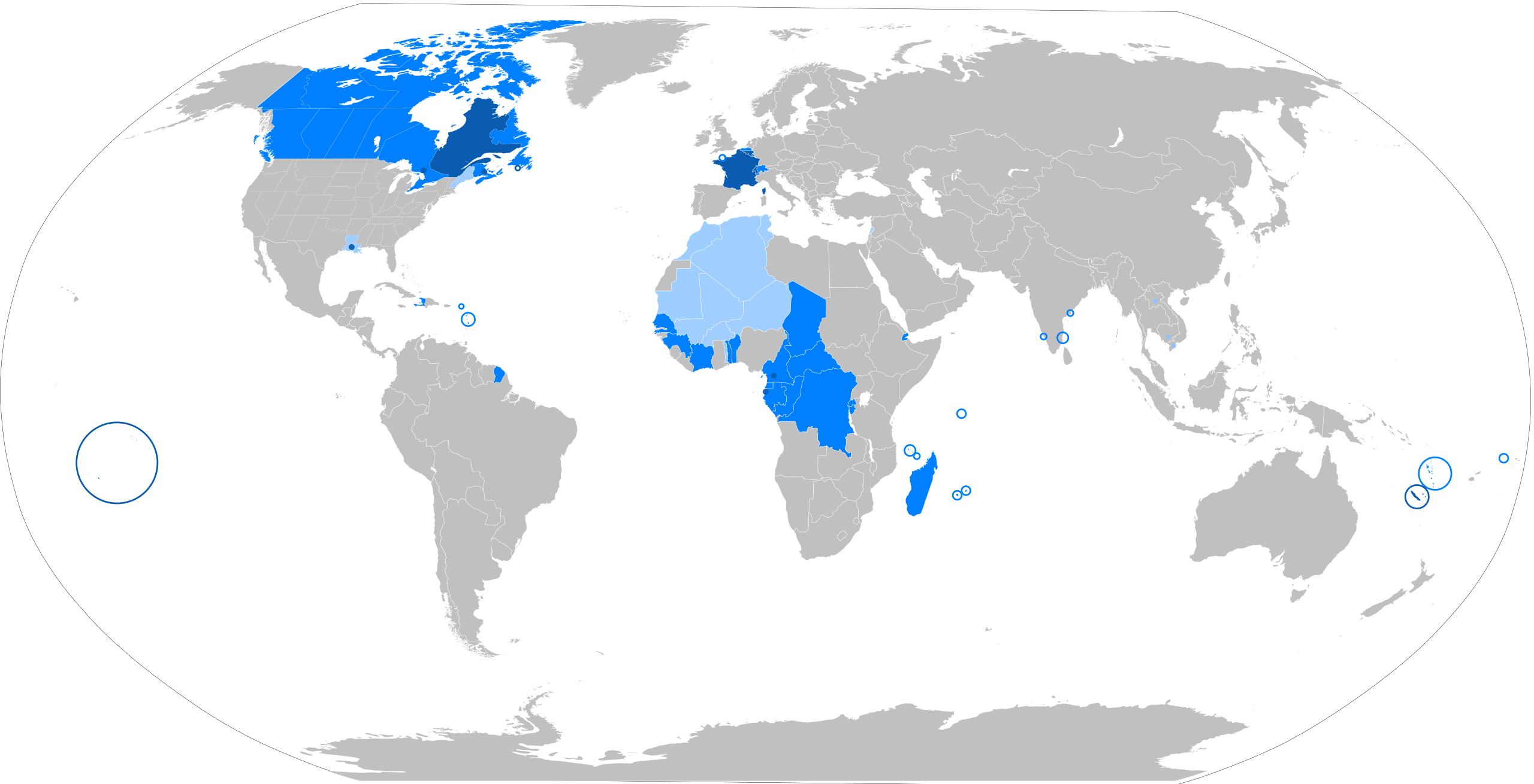
| Description | The French language in the world
States where French is the majority native language (Dots: cities with native transmission, typically a minority) States where it is an official de jure language States where it is an administrative language or culturally important but without official status The following things have been changed from the old "Map-Francophone World.png": Vietnam, Cambodia and Laos are no longer fully colored in light blue, this is because French is not used there very much these days. Mauritania, Morocco, Algeria, Tunisia, Mali, Burkina Faso and the Western Togoland area of Ghana have been colored light blue, because the French language is widely used but it has no official status. |
| Source | Wikimedia Commons |
| Author | aaker (original PNG file: https://commons.wikimedia.org/wiki/File:New-Map-Francophone_World.PNG ) |
| Permission | See Commons |
Licensing[edit]
Creative Commons Attribution-ShareAlike 4.0 International (CC BY-SA 4.0)
This file is licensed under the Creative Commons Attribution-ShareAlike 4.0 International license.
You are free to:
- Share — copy and redistribute the material.
- Adapt — remix, transform, and build upon the material.
Under the following conditions:
- Attribution — appropriate credit must be given.
- ShareAlike — derivative works must be distributed under the same license.
Official license: CC BY-SA 4.0
Original attribution and file history: Wikimedia Commons
File history
Click on a date/time to view the file as it appeared at that time.
| Date/Time | Thumbnail | Dimensions | User | Comment | |
|---|---|---|---|---|---|
| current | 01:20, 2 June 2026 | | 512 × 262 (878 KB) | Maintenance script (talk | contribs) | == Summary == Importing file |
You cannot overwrite this file.
File usage
The following 2 pages use this file:
