File:Miami neighborhoodsmap.png
Original file (4,063 × 3,144 pixels, file size: 869 KB, MIME type: image/png)
Summary[edit]
| Summary | |
|---|---|
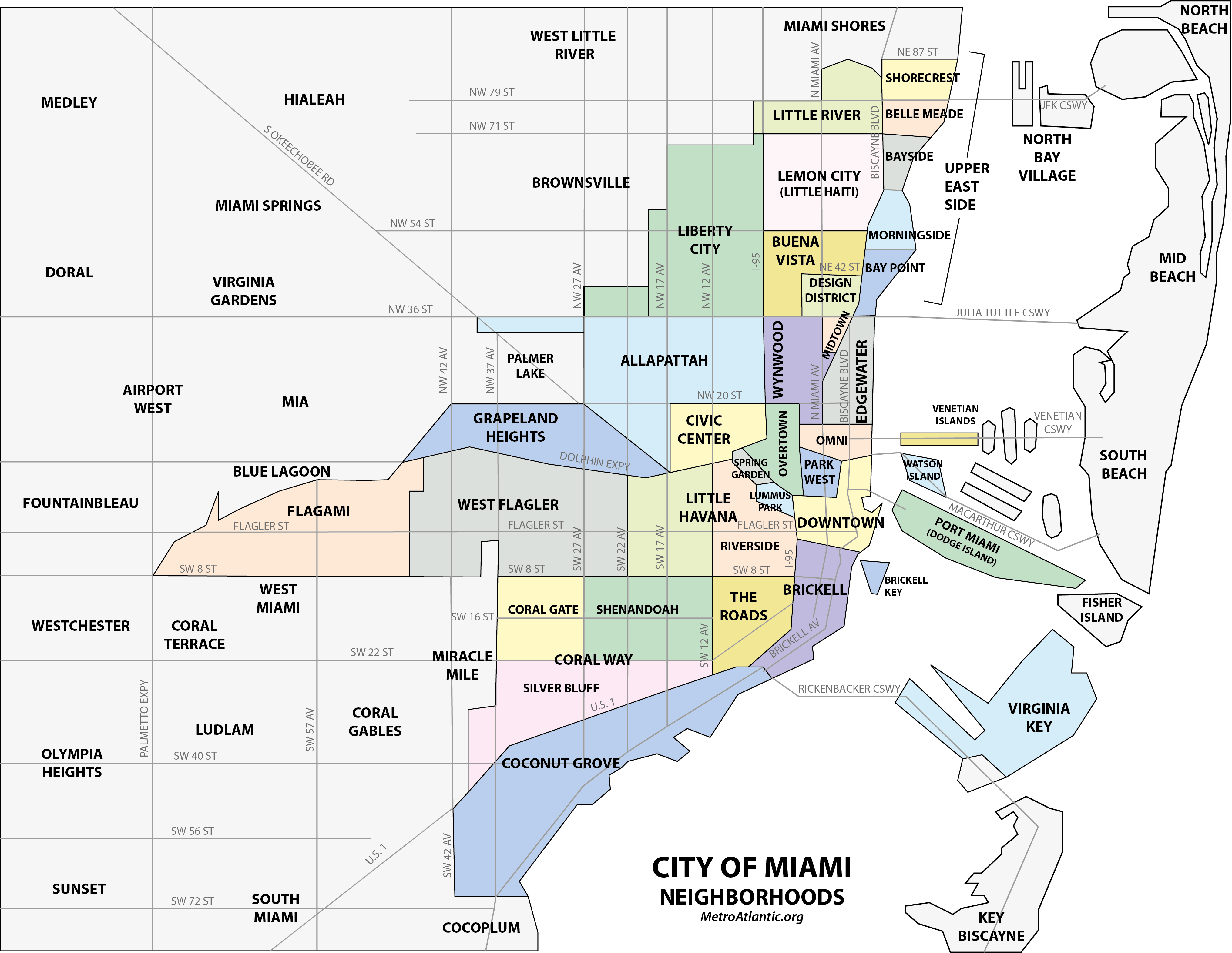
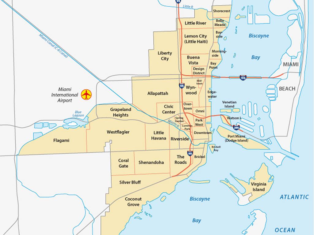
| Description | Map of the neighborhoods of the City of Miami, Florida, United States[1][2][3][4][5][6][7][8][9]
References
↑ http://www.beaconcouncil.com/web/pdf/Miami_major_neighborhoods.pdf ↑ http://www.miamiandbeaches.com/visitors/Neighborhoods.aspx ↑ http://www.miamigov.com/NETS/pages/AboutNET/Services.asp ↑ http://www.miamigov.com/GISWebPortal/pages/default.asp ↑ http://www.miaminu.org/CityMaps.html ↑ http://www.ci.miami.fl.us/Planning/pages/community_planning/CommunityPlanning.asp ↑ http://www.miamidda.com/main_getting_around.asp ↑ https://www.holidaywolf.com/wp/wp-content/uploads/2023/07/miami-neighborhoods-map.jpg |
| Source | Wikimedia Commons file page |
| Author | Comayagua99 (talk) |
| Permission | See original Commons license details. |
Licensing[edit]
Creative Commons Attribution-ShareAlike 3.0 Unported (CC BY-SA 3.0)
This file is licensed under the Creative Commons Attribution-ShareAlike 3.0 license.
Official license: CC BY-SA 3.0
License page: CC BY-SA 3.0
Original attribution and file history: Wikimedia Commons
File history
Click on a date/time to view the file as it appeared at that time.
| Date/Time | Thumbnail | Dimensions | User | Comment | |
|---|---|---|---|---|---|
| current | 22:26, 8 June 2026 | Error creating thumbnail: File with dimensions greater than 12.5 MP | 4,063 × 3,144 (869 KB) | Maintenance script (talk | contribs) | == Summary == Importing file |
You cannot overwrite this file.
File usage
The following page uses this file:
