File:Prima Europe tabula.jpg
From WikiMD's WELLNESSPEDIA

Size of this preview: 800 × 572 pixels. Other resolutions: 2,560 × 1,832 pixels | 6,000 × 4,293 pixels.
Original file (6,000 × 4,293 pixels, file size: 9.63 MB, MIME type: image/jpeg)
Summary[edit]
| Summary | |
|---|---|
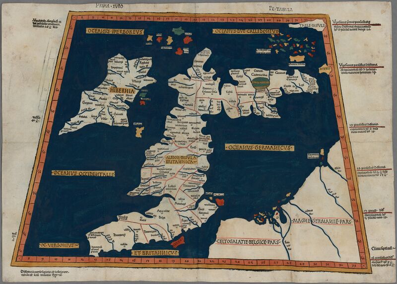
| Description | One of the earliest surviving copies of Ptolemy's 2nd century map of the British Isles. Originally published in Ptolemy's Geographia. This is the second issue of the 1482 map, also printed at Ulm, which was the first woodcut map of the British Isles and the first to be printed outside Italy. |
| Source | Wikimedia Commons file page |
| Author | Ptolemy |
| Permission | See original Commons license details. |
Licensing[edit]
Public Domain
This file is in the public domain and may be used without restriction.
Please see the linked source page for the original file history, attribution information, and licensing details.
Original attribution and file history: Wikimedia Commons
File history
Click on a date/time to view the file as it appeared at that time.
| Date/Time | Thumbnail | Dimensions | User | Comment | |
|---|---|---|---|---|---|
| current | 03:24, 5 June 2026 | | 6,000 × 4,293 (9.63 MB) | Maintenance script (talk | contribs) | == Summary == Importing file |
You cannot overwrite this file.
File usage
The following 2 pages use this file:
