File:WheatYield.png
From WikiMD's WELLNESSPEDIA
Size of this preview: 800 × 489 pixels. Other resolution: 1,476 × 902 pixels.
Original file (1,476 × 902 pixels, file size: 535 KB, MIME type: image/png)
Summary[edit]
| Summary | |
|---|---|
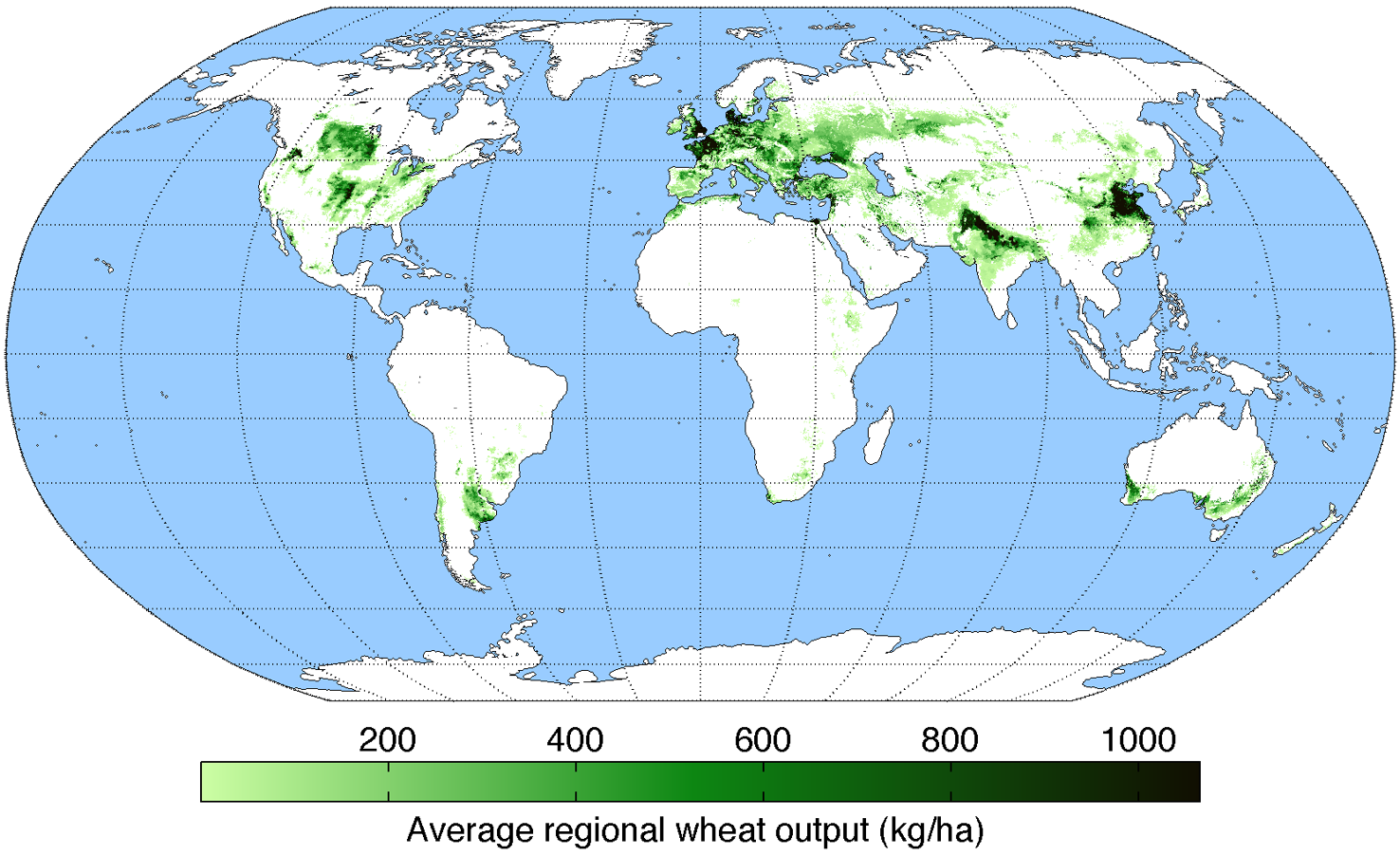
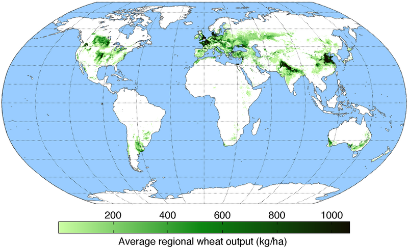
| Description | Map of wheat production (average percentage of land used for its production times average yield in each grid cell) across the world compiled by the University of Minnesota Institute on the Environment with data from: Monfreda, C., N. Ramankutty, and J.A. Foley. 2008. Farming the planet: 2. Geographic distribution of crop areas, yields, physiological types, and net primary production in the year 2000. Global Biogeochemical Cycles 22: GB1022 |
| Source | Wikimedia Commons file page |
| Author | AndrewMT |
| Permission | See original Commons license details. |
Licensing[edit]
Creative Commons Attribution-ShareAlike 3.0 Unported (CC BY-SA 3.0)
This file is licensed under the Creative Commons Attribution-ShareAlike 3.0 license.
Official license: CC BY-SA 3.0
Original attribution and file history: Wikimedia Commons
File history
Click on a date/time to view the file as it appeared at that time.
| Date/Time | Thumbnail | Dimensions | User | Comment | |
|---|---|---|---|---|---|
| current | 12:48, 29 May 2026 | | 1,476 × 902 (535 KB) | Maintenance script (talk | contribs) | == Summary == Importing file |
You cannot overwrite this file.
File usage
The following 2 pages use this file:
