File:Willem Blaeu00.jpg
From WikiMD's WELLNESSPEDIA
Size of this preview: 786 × 600 pixels. Other resolution: 1,140 × 870 pixels.
Original file (1,140 × 870 pixels, file size: 399 KB, MIME type: image/jpeg)
Summary[edit]
| Summary | |
|---|---|
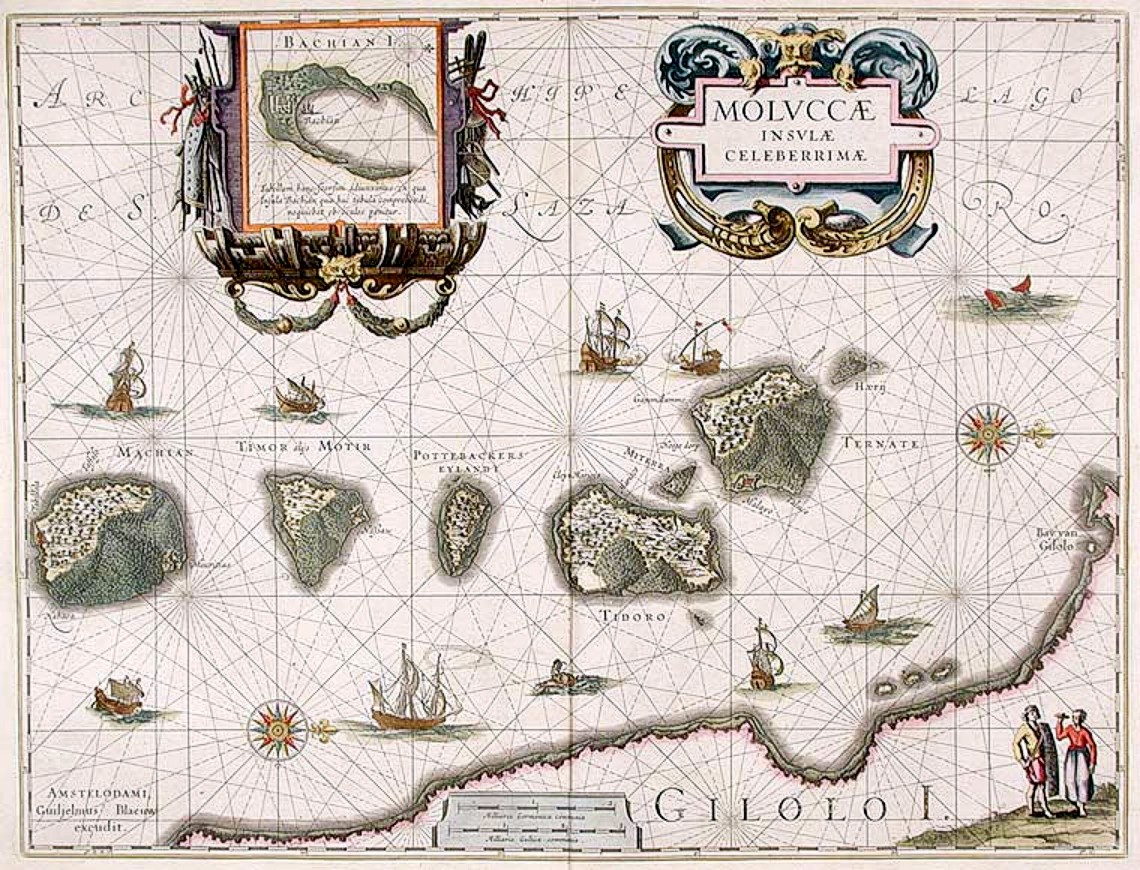
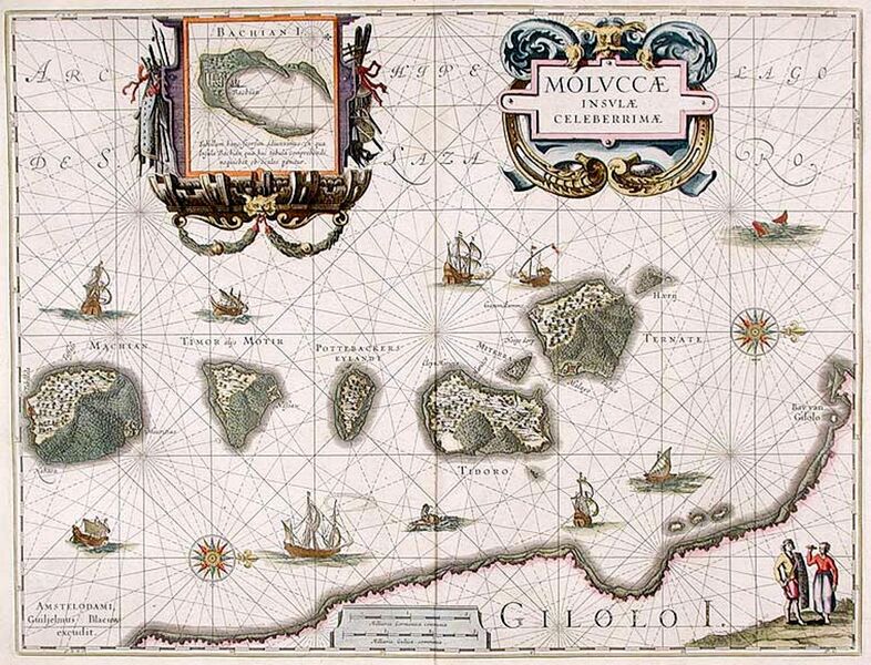
| Description | "Moluccæ Insulæ Celeberrimæ". Blaeu's map, which first appeared in 1630 in the Atlantis Appendix., was the first large-scale, detailed map of the now Dutch-controlled islands. It shows the heavily forested nature of the islands and the recently constructed forts. North is on the right direction, with Ternate in the rightmost island followed by Tidore, Mare, Moti and Makian islands. The bottom is the Gilolo (Jailolo or Halmahera) Island. Inset on the top is Bacan Island. |
| Source | Wikimedia Commons file page |
| Author | Willem Janszoon Blaeu (1571-1638) |
| Permission | See original Commons license details. |
Licensing[edit]
Public Domain
This file is in the public domain and may be used without restriction.
Please see the linked source page for the original file history, attribution information, and licensing details.
Original attribution and file history: Wikimedia Commons
File history
Click on a date/time to view the file as it appeared at that time.
| Date/Time | Thumbnail | Dimensions | User | Comment | |
|---|---|---|---|---|---|
| current | 03:32, 5 June 2026 | | 1,140 × 870 (399 KB) | Maintenance script (talk | contribs) | == Summary == Importing file |
You cannot overwrite this file.
File usage
The following 2 pages use this file:
